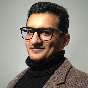
Prof. Dr. Carsten Keßler
Geographic Information Systems and Spatial Data Analysis
Prof. Dr. Carsten Keßler received his PhD from the University of Münster, Germany, focusing on context-aware information retrieval. He has worked as a consultant for the United Nations Office for the Coordination of Humanitarian Affairs in Geneva and held faculty positions at Hunter College, City University of New York, USA, and Aalborg University Copenhagen, Denmark. He joined the Department of Geodesy in April 2021 as professor for geographic information systems and spatial data analysis.
Research areas:
- Spatio-temporal analysis, including climate impact research
- Research data infrastructures
- Data protection and privacy in the context of geospatial data
- Semantic interoperability of geoinformation and Linked Open Data
Team


Research Projects
Current
- THALES TP 10: Digital participation for community-specific resilience to extreme events. Funded by the Federal Ministry of Research, Technology and Space, 2026–2027.
- DiKomAll – Digital municipality for all. Funded by the Federal Ministry of Research, Technology and Space, 2023–2026.
- AquaINFRA – Restoring our oceans, seas, coastal and inland waters. Horizon Europe, 2022–2026.
- NFDI4Earth – National Research Data Infrastructure for the Earth System Sciences; German Research Foundation (DFG), 2021–2026.
- KomMonitor – Municipal Monitoring for Spatial Development.
Completed
- QuDI – “A Quarter Data Infrastructure for Participatory, Sustainable Living in the Future City Quarter.” Funded by the Ministry of Culture and Science of North Rhine–Westphalia within the Applied Excellence Department, 2023–2025.
- OER4SDI – Open Educational Resources for Spatial Information Infrastructures. Funded by the Ministry of Culture and Science of North Rhine–Westphalia, 2022–2024.
- SEED4NA – SDI and EO Education and Training for North Africa. ERASMUS+, 2020–2024.
- SPIDER – open SPatial data Infrastructure eDucation nEtwoRk. ERASMUS+, 2019–2023.
Courses
Bachelor's programs
- Introduction to Geoinformatics (Bachelor Geoinformatics, Bachelor Surveying)
Master's programs
- Spatial data modeling (Master Geoinformatics)
- Spatial decision support (Master Geoinformatics, Master Geodesy)
Committees
Internal
- Ombudsperson for good scientific practice at Bochum University of Applied Sciences
- Department council
- Senate's commission “Research and Transfer”
External
- Council of the Association of Geographic Information Laboratories Europe
- Steering group of the GeoIT Round Table NRW
Selected publications
A complete list of publications is available on ORCID and Google Scholar.
- Farzaneh Sadeghi, Auriol Degbelo, Carsten Keßler, Reza Zolnouri (2025) Applying the FAIR Principles to Open Educational Resources: A Semantic Similarity Approach to Improve Resource Discovery. IEEE Access 13: 136626 - 136642. DOI:10.1109/ACCESS.2025.3594963
- Carsten Keßler, Albert Remke, Henryk Hodam, Fabian Przybylak, Andreas Rienow (2024) OER4SDI: Open Educational Resources for Spatial Data Infrastructures. AGILE: GIScience Series 5, 9. DOI:10.5194/agile-giss-5-9-2024
- Marina Georgati, Henning Sten Hansen, Carsten Keßler (2023) Random Forest Variable Importance Measures for Spatial Dynamics: Case Studies from Urban Demography. ISPRS International Journal of Geo-Information 12 (11), 460. DOI:10.3390/ijgi12110460
- Irma Kveladze, Marina Georgati, Carsten Keßler, Henning Sten Hansen (2023) Analytics of historical human migration patterns: use cases of Amsterdam and Copenhagen. Journal of Location Based Services 17(4), 426-446. DOI:10.1080/17489725.2023.2238658
- Peter J. Marcotullio, Carsten Keßler, Balázs M. Fekete (2022) Global urban exposure projections to extreme heatwaves. Frontiers in Built Environment. DOI:10.3389/fbuil.2022.947496.
- Casper Samsø Fibæk, Carsten Keßler, Jamal Jokar Arsanjani, Marcia Luz Trillo (2022) A deep learning method for creating globally applicable population estimates from sentinel data. Transactions in GIS, 26(8), 3147-3175 DOI:10.1111/tgis.12971.
- Ezra Francis Leslie Trotter, Ana Cristina Mosebo Fernandes, Casper Samsø Fibæk, Carsten Keßler (2022) Machine learning for automatic detection of historic stone walls using LiDAR data. International Journal of Remote Sensing, 43:6, 2185-2211, DOI:10.1080/01431161.2022.2057206
- Maria Andrakakou, Carsten Keßler (2022) Investigating configurational and active centralities: The example of metropolitan Copenhagen. Environment and Planning B: Urban Analytics and City Science 47(7):1949–1966. DOI:10.1177/23998083211072861.
- Javier Elío, Marina Georgati, Henning Sten Hansen, Carsten Keßler (2022). Migration Studies with a Compositional Data Approach: A Case Study of Population Structure in the Capital Region of Denmark. In: Gervasi, O., Murgante, B., Misra, S., Rocha, A.M.A.C., Garau, C. (eds) Computational Science and Its Applications – ICCSA 2022 Workshops. ICCSA 2022. Lecture Notes in Computer Science, vol 13379. Springer, Cham. DOI:10.1007/978-3-031-10545-6_39
- Marina Georgati, João Monteiro, Bruno Martins, Carsten Keßler (2022) Spatial Disaggregation of Population Subgroups Leveraging Self-Trained Multi-Output Gradient Boosting Regression Trees. AGILE GIScience Ser., 3, 15, DOI:10.5194/agile-giss-3-5-2022
- Casper Samsø Fibæk, Carsten Keßler, Jamal Jokar Arsanjani (2021) A multi-sensor approach for characterising human-made structures by estimating area, volume and population based on sentinel data and deep learning. International Journal of Applied Earth Observation and Geoinformation, Volume 105, 102628. DOI:10.1016/j.jag.2021.102628
- Peter J. Marcotullio, Carsten Keßler, Rebeca Quintero Gonzalez, and Michael Schmeltz (2021) Urban Growth and Heat in Tropical Climates. Frontiers in Ecology and Evolution. DOI:10.3389/fevo.2021.616626
- Casper Samsø Fibæk, Hanna Laufer, Carsten Keßler, and Jamal Jokar Arsanjani (2021) Geodata-driven approaches to financial inclusion – Addressing the challenge of proximity. International Journal of Applied Earth Observation and Geoinformation, Volume 99, July 2021, 102325. DOI:10.1016/j.jag.2021.102325
- Peter J. Marcotullio, Carsten Keßler and Balázs M. Fekete (2021) The future urban heat-wave challenge in Africa: Exploratory analysis. Global Environmental Change Vol. 66, January 2021, 102190. https://doi.org/10.1016/j.gloenvcha.2020.102190
- Marina Georgati and Carsten Keßler (2021) Spatially Explicit Population Projections: The case of Copenhagen, Denmark, AGILE GIScience Ser., 2, 28, DOI:10.5194/agile-giss-2-28-2021
- Peter J. Marcotullio, Carsten Keßler and Balázs M. Fekete (2020) Future megacity-regions and heatwave exposure. In: Danielle Labbé and André Sorensen, eds.: Handbook of Megacities and Megacity-Regions, pp.309–326. Edward Elgar Publishing, ISBN: 978-1-78897-269.
- Grant D. McKenzie, Krzysztof Janowicz and Carsten Keßler (2020) Uncovering spatiotemporal biases in place-based social sensing. In: P. Partsinevelos, P. Kyriakidis, and M. Kavouras, Proceedings of the 23rd AGILE Conference. DOI:10.5194/agile-giss-1-14-2020
- Carsten Keßler and Grant D. McKenzie (2019) Consistency Across Geosocial Media Platforms. In: Proceedings of the 15th International Conference on Location Based Services, Vienna, Austria, 11—13 November 2019.
- Marina Georgati and Carsten Keßler (2019) A 3D Routing Service for Indoor Environments. In: Proceedings of the 15th International Conference on Location Based Services, Vienna, Austria, 11—13 November 2019.
- Nikmal Raghestani and Carsten Keßler (2019) Route Optimisation for Winter Maintenance. In: Phaedon Kyriakidis, Diofantos Hadjimitsis, Dimitrios Skarlatos, Ali Mansourian, eds., Geospatial Technologies for Local and Regional Development – Proceedings of the 22nd AGILE Conference on Geographic Information Science. Conference proceedings, AGILE 2019, Limassol, Cyprus, 17-20 June, 2019. Springer Lecture Notes in Geoinformation and Cartography: 125-142.
- Sven Schade, Carlos Granell, Glenn Vancauwenberghe, Carsten Keßler, Danny Vandenbroucke, Ian Masser, Michael Gould (2019) Geospatial Information Infrastructures. In: Huadong Guo, Michael Goodchild, Alessandro Annoni (eds.), Manual of Digital Earth, pp. 161–190. Springer/International Society for Digital Earth. DOI:10.1007/978-981-32-9915-3


