Department of Geodesy
Innovative, practical, future-proof
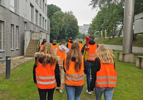
Welcome to the Department of Geodesy!

It is hard to imagine our everyday life without spatial data. We let ourselves be located, go geocaching, navigate through unknown areas, plan trips with the help of map services and aerial images by looking for sights or a restaurant and looking at pictures of our accommodation in advance, we look at aerial images and building plans and much more. The question of where is a recurring concern for us and geodesy provides answers. The Department of Geodesy represents the two innovative sub-disciplines of surveying and geoinformatics in teaching and research. Since the winter semester 2007/2008, only Bachelor's and Master's degree programmes have been offered. A motivated team of teachers and research assistants supports students on their way to the Bachelor and Master of Engineering degrees and uses modern approaches in research projects to gain new insights. To ensure that the Bochum University of Applied Sciences always has a practical orientation, only teachers who have several years of professional experience are entrusted with the training of students. Due to the high demand on the labour market, our geodesy degree programmes offer excellent career prospects and a secure future.
Facilities and Institutes
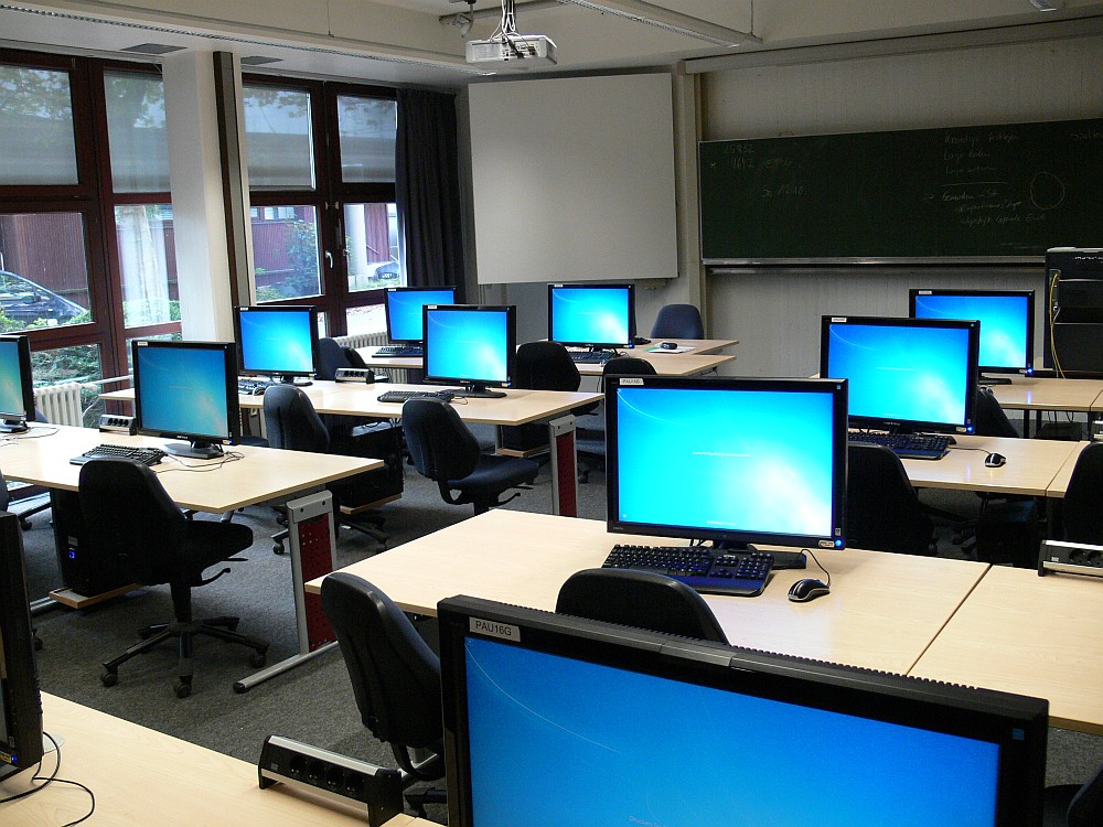
The Laboratory for Geoinformatics provides students in the fields of Geoinformatics and Surveying with practical insights into the development, operation, and management of complex software systems for addressing spatial questions.
Additionally, the Laboratory for Geoinformatics serves as a collaborative partner for institutions in research, administration, and business. By integrating into courses in bachelor's and master's programs, as well as incorporating practical phases and thesis projects, innovative project ideas and enhancements to existing software products can be implemented collaboratively with students or as part of business contracts.
The work areas of the Laboratory for Geovisualization in the Department of Geodesy at the University of Bochum in room A0-22 encompass, among others, the following thematic areas:
- Cartography: "Traditional" map production (desktop mapping), generalization, thematic cartography, print output.
- Web Mapping: Map representations on the internet, development of web-based mapping applications and services (map services), Geo-UX, and product design.
- Interactive 3D Geovisualization: Representations of geospatial data and processes in three-dimensional visualization spaces; interactive real-time rendering applications; interaction design.
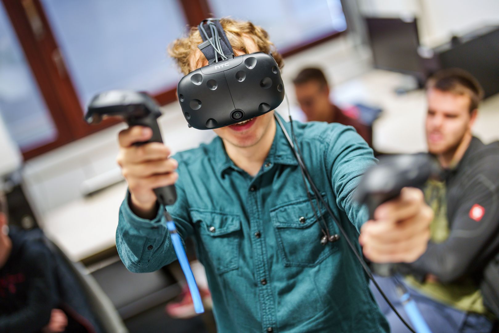
- Virtual Reality: Immersive VR applications, for example, as desktop VR or supported by head-mounted displays ("VR glasses").
- Augmented Reality: "Video-See-Through" (cameras of mobile devices, HoloLens), projection-based (e.g., tabletop, floor, or wall), or through holographic solutions ("AR glasses").
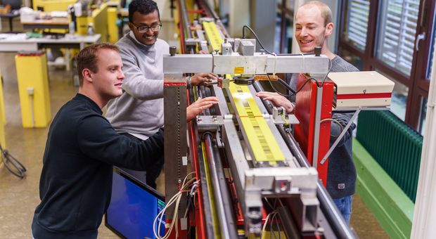
The Laboratory for Industrial Metrology, under the direction of Prof. Dr. Lipkowski, utilizes its equipment for teaching and research in the programs offered by the Department of Geodesy.
The goal is to provide students with education that offers excellent career prospects. Therefore, both teaching and research focus on application-oriented issues. The outstanding equipment in the Laboratory for Industrial Measurement Technology provides students with the best opportunities to practically familiarize themselves with measurement systems used in real industrial environments.
In the Bachelor's program in Surveying and the Master's program in Geodesy, Laser Trackers are employed for teaching in the field of tactile industrial measurement technology. Laser Trackers are mobile, polar measurement systems that allow for the highly accurate determination of three-dimensional coordinates of objects in close proximity.
The laboratory in room A01-18, with dimensions of 20.6 x 6.7 x 3.4 [m], is consistently climate-controlled at a temperature of 20° [C] and provides various measurement stations for the calibration of geodetic measuring instruments. Across the entire laboratory space, there is a network of 10 measurement pillars, all independently founded from the surrounding building, making them unaffected by the vibration behavior of the floor and the entire structure.
The laboratory also includes a 250 [m] long calibration track on the university campus, which can be extended to 510 [m] using a deflection mirror. It consists of 11 stably founded survey pillars, whose relative distances (target distances) are regularly determined with high precision and subjected to deformation analysis.
The laboratory offers the calibration of numerous geodetic sensors as a service!
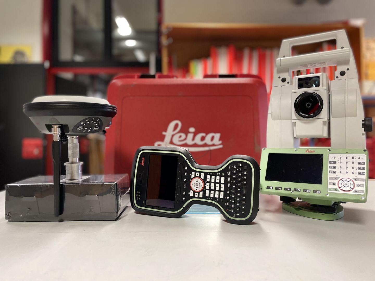
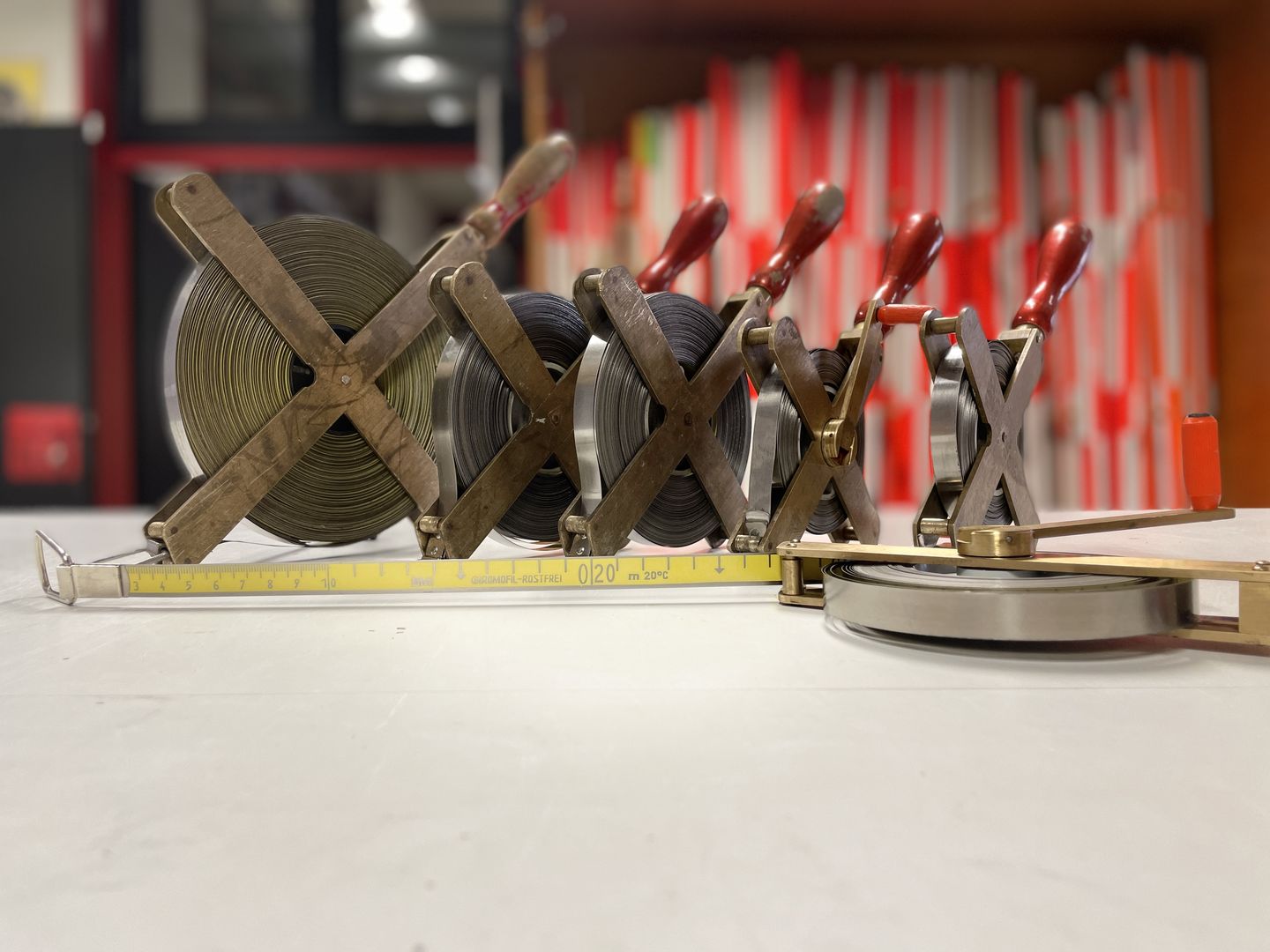
Here, you will find everything necessary for hands-on teaching. From modern theodolites and GNSS systems to levels of various accuracy classes, as well as barometers and tension meters, students have access to everything needed for the successful completion of individual practical exercises.
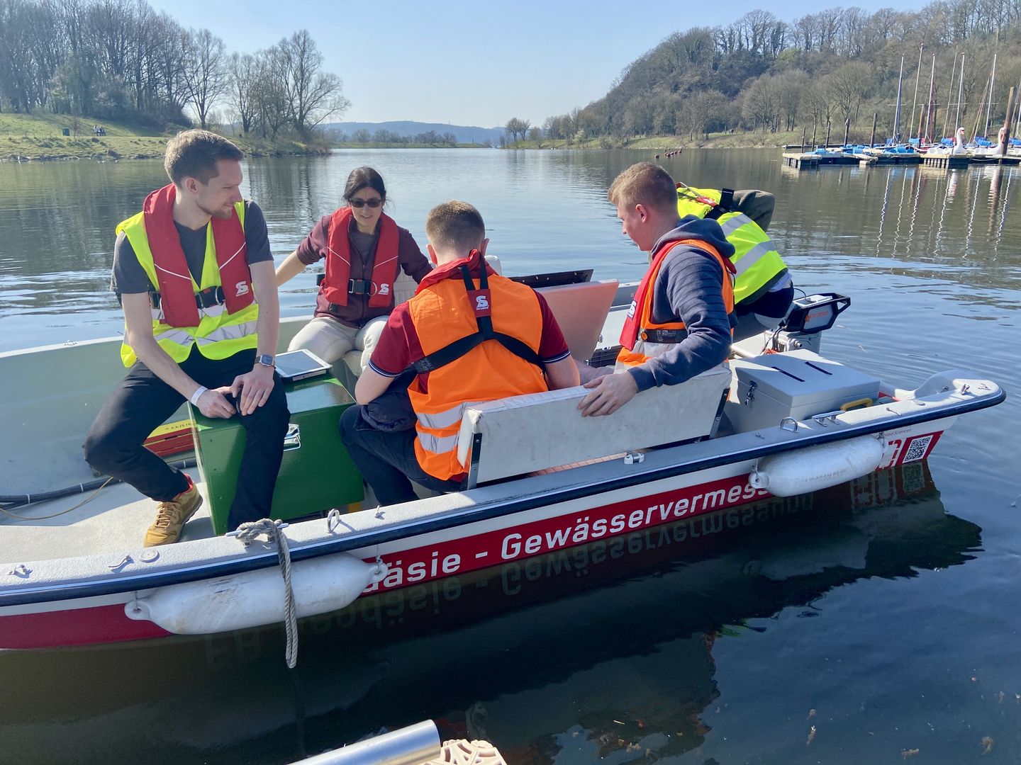
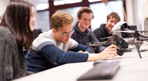
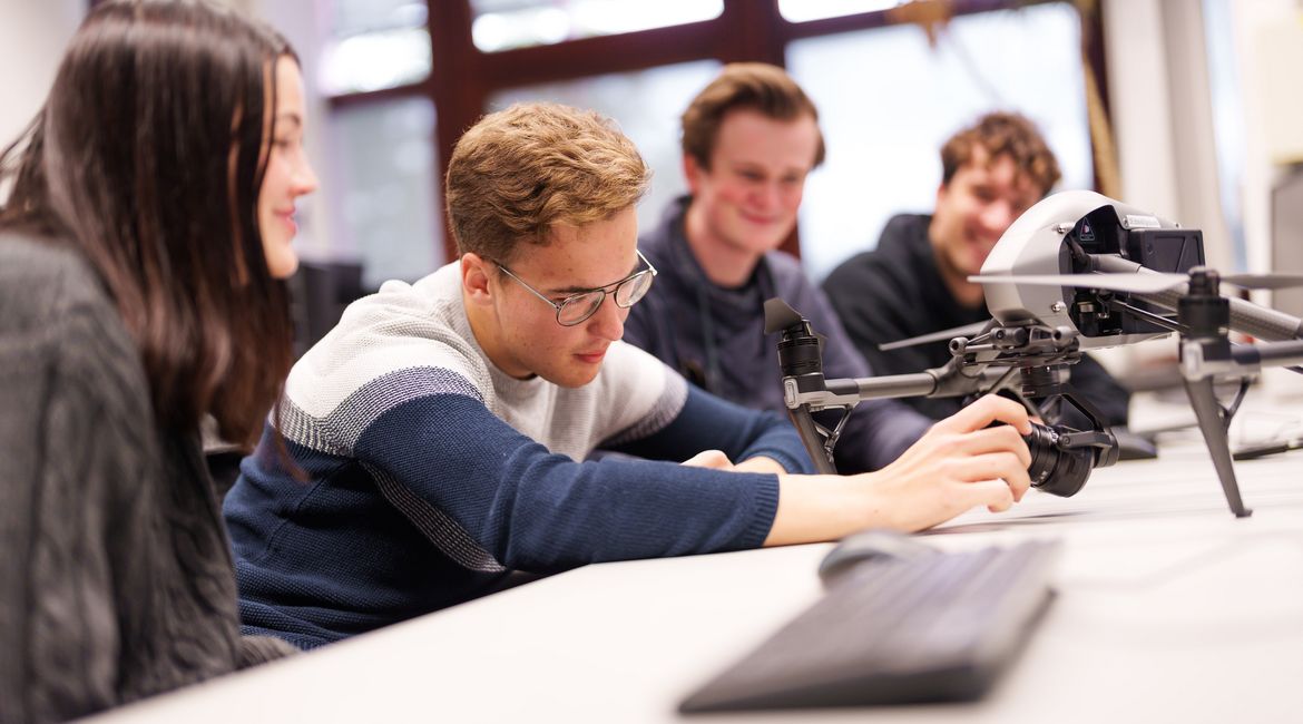
The Laboratory for Mobile Mapping Systems, under the leadership of Prof. Dr. Gundlich in the programs of Surveying and Geoinformatics, is utilized for both teaching and research purposes.
Geodesy Measurement Boat with Multibeam Echosounder System:
- Used in bachelor's and master's theses, as well as in lectures and student software projects.
- Applications include hydrographic measurements, data evaluations, and the creation of interactive geovisualizations.
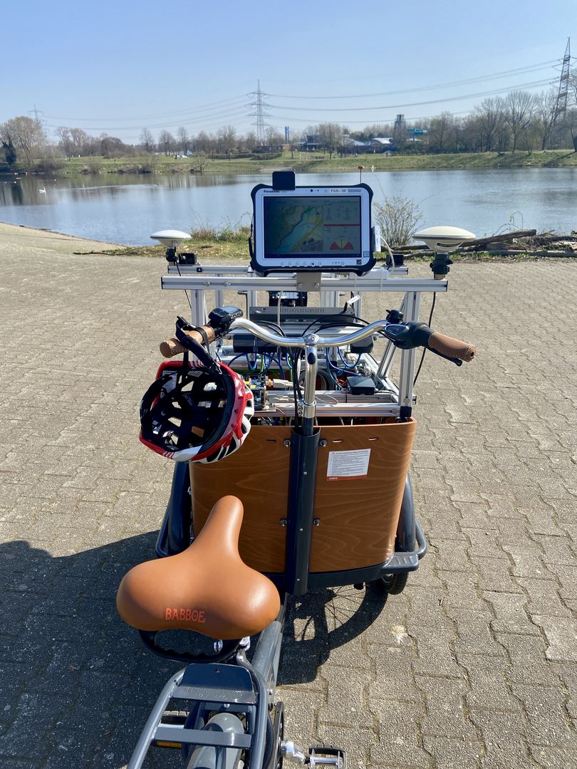
Multisensor Cargo Bike of the Department of Geodesy at the Hochschule Bochum:
- A multisensor system comprising:
- Laserscanner
- Camera system with six cameras
- Inertial Measurement Unit (IMU) with GNSS receiver
- GNSS antenna array
- Toughpad for data recording, control, and monitoring during travel
- A multisensor system comprising:
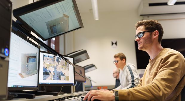
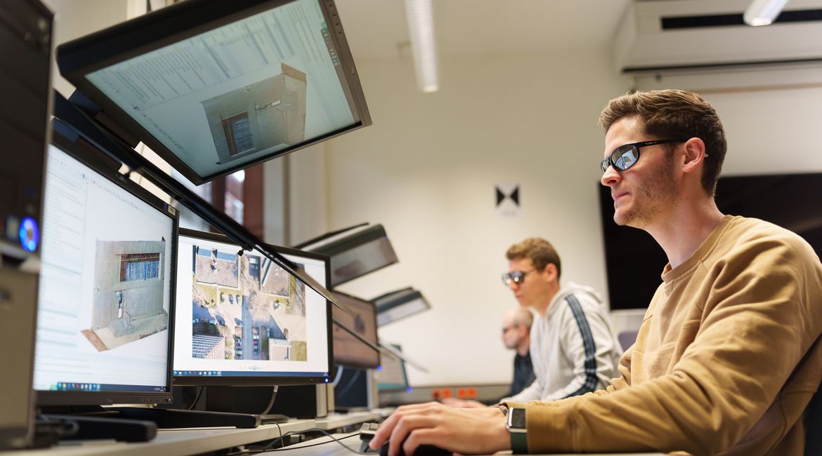
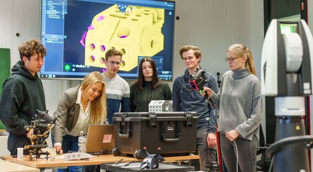
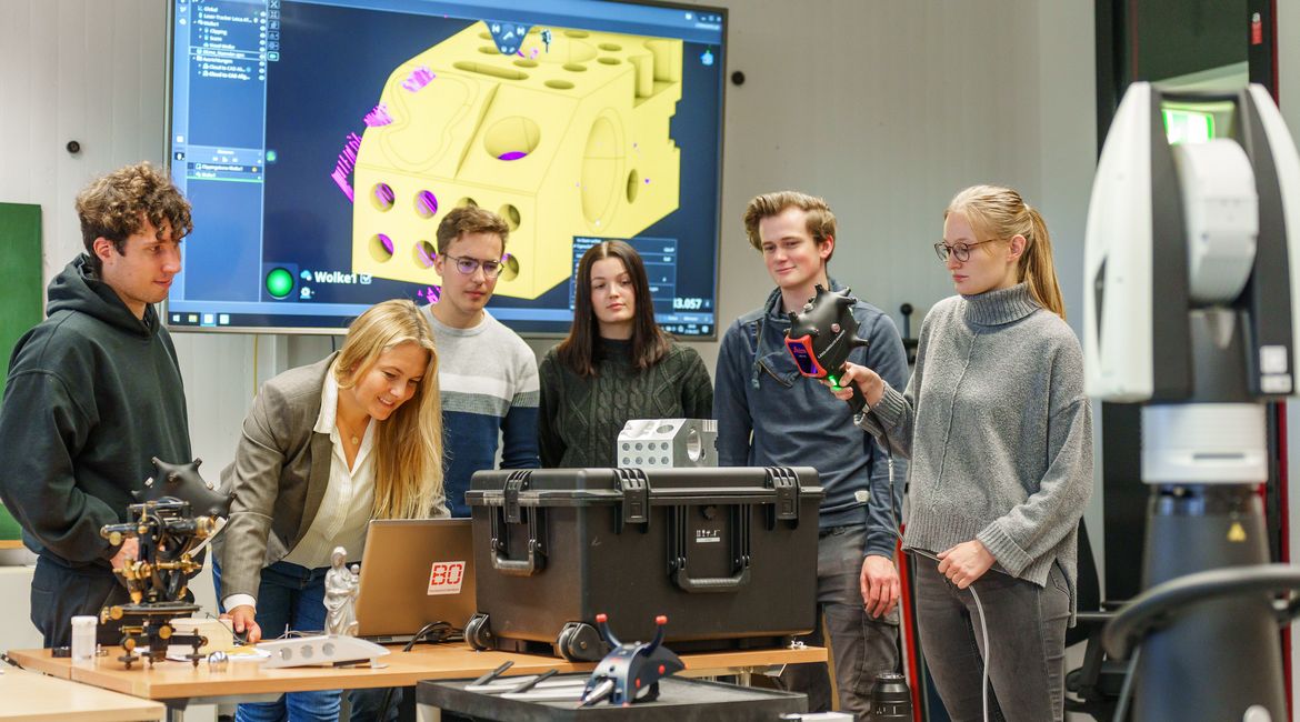
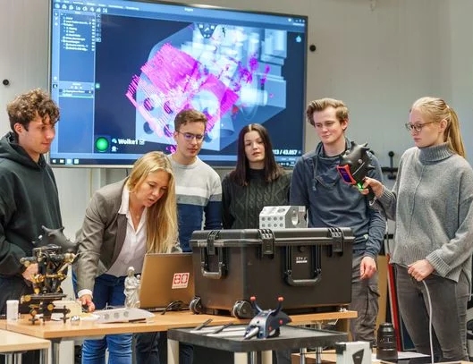
The Laboratory for Optical 3D Metrology in room A1-23 is used for teaching and research under the scientific direction of Prof. Dr Ansgar Greiwe in the Land Surveying and Geoinformatics degree programmes. Last update: 22.11.2023
Projects:
- GPS applications
- GPS-Reference station
- Reference stations that transmit RTCM data via the internet
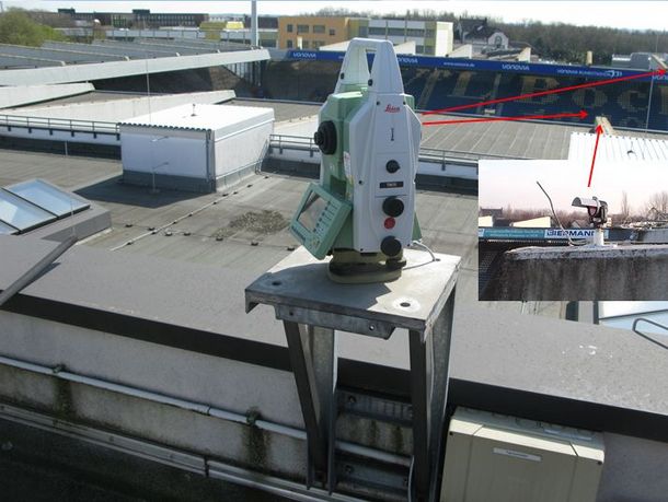
- Stadium surveillance
- Time series analysis of the data from the GNSS reference station at UAS_BO
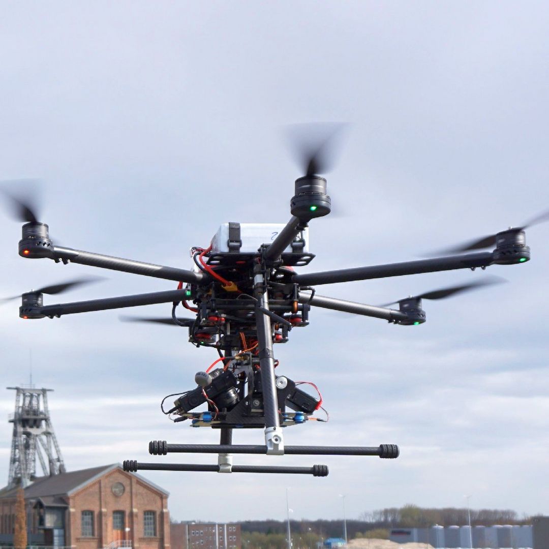
- Land Surveying from the air with unmanned aerial vehicles (UAVs)
- SMMS- slow motion measurement system
Contact us
For international prospective students
Dean's office
For all others