Geoinformatics
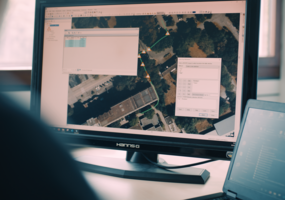
What do Google Earth, Jurassic World Alive and geocaching have in common? They all work with spatial data. Geoinformatics is one of the applied computer sciences and deals with the analysis and processing of all data with a spatial reference, i.e. relating to specific locations or regions on or near the earth's surface. The Bachelor's degree programme in Geoinformatics combines fields of geosciences - such as geodesy or geography - with computer science methods in an exciting way.
At a glance
- Degree:
- Bachelor of Engineering
- Standard period of study:
- 7 or 9 (cooperative degree) semesters
- Programme start:
- Winter semester
- Campus:
- Central Campus Bochum
- Instruction language:
- German
- Credit points:
- 210 credit points
- Type of programme:
- Full-time and cooperative studies
- Type of admission (NC):
- Open admission (no NC)
As a geoinformatician, you analyse the "where" and look for solutions - whether with satellite data of large areas of the earth's surface or with details of a few streets. Imagine that the amount of geodata available worldwide is constantly growing and becoming Big GeoData. They are absolutely vital for many sectors of the economy and scientific disciplines, making geoinformaticians more in demand than ever.
The Geoinformatics degree programme prepares you to use geodata in a targeted, effective and sustainable way. The focus is on managing and analysing spatial data with special IT applications and software development. In practical projects and exercises, you will analyse complex geodata sets or learn how to visualise data in the form of map applications on the web or in virtual reality. At the beginning of the degree programme, you will also learn the basics of surveying and the various techniques used to capture spatial data. Compulsory elective modules allow you to steer your studies in the direction that suits your interests. After your Bachelor's degree, you can also study the appropriate Master's programme with us.
For documents such as the module handbook, study plan and examination regulations, please visit the German page.
School-leaving certificate
- Advanced technical college entrance qualification (academic + practical) or Abitur or comparable foreign qualification
or
- An entrance qualification recognised as equivalent (studies without Abitur or Fachhochschulreife)
- Pre-study work placement
No pre-study work placement required
International students
- A certificate recognised for studying in Germany and proven language skills
Co-operative study model (KIA / KIS)
- Advanced technical college entrance qualification (school + practical) or Abitur or comparable foreign qualification
or
- An entrance qualification recognised as equivalent (studies without Abitur or Fachhochschulreife)
and
- A training (KIA) or internship contract with a cooperating company is available for enrolment
Career Prospects
External content
YouTube Video
We need your consent to show you a video from YouTube here. You can display this (and therefore all other YouTube content on our website) after you have given your consent.
With your consent, personal data may be transferred to third-party platforms. You can find out more in our privacy policy . You can opt out at any time via the Cookie settings link at the bottom of the page.
The best thing about geoinformatics is its versatility. It moves with the times and helps to solve current problems in society, science and industry. This is reflected in the career opportunities. Wherever the question of "where" plays a role, specialists like you are in demand.
- you develop route planning apps for car or bicycle traffic in the mobility sector or drive autonomous driving forward in software companies.
- in the private sector, you support companies in planning new locations, optimise route planning in logistics companies or plan the route for energy suppliers in your region.
- in agriculture, you create smart route plans for large agricultural operations and monitor the nutrient requirements of plant production by analysing image data.
- in the event of a disaster, you support emergency services on site with emergency maps that provide important information on flooded or buried roads, for example.
- you can contribute your expertise to research and document climate change using modern satellite data to help stop it.
- by monitoring population data in statistical portals developed by you, you can support municipal planning in the creation of liveable living spaces for all age groups and lifestyles.
- you can join the Criminal Investigation Department as an expert in spatial crime forecasting.

Contact
Help with application, enrolment, financing questions or recognition of examination results